Cajas National Park
Location: Southern highlands of Ecuador
Date of trek: October, 2012
Duration/total distance: three days/30 kilometers
STORY AND PHOTOS BY BANI AMOR
The already-indeterminate path I was supposed to be following receded into thick clouds that swept me up in currents of white mist. I kept moving toward what I hoped was the apex of the steep mountain my friend and I had somehow ended up climbing. Eventually, the ground leveled and the clouds parted: a panorama of about seven lakes sitting in valleys of velvety green mountains came into view below.
“Donde estamos?” yelled my Chilean companion Rocio from somewhere in the fog downhill: Where are we?
“I don’t know!” I screamed back in Spanish. “But it’s ok!”
Just then the veil of clouds closed in on the scene again and I couldn’t make out anything beyond my own body and the patch of grass beneath my feet.
***
Cajas National Park is known locally as El Parque de Mil Lagos or ‘Land of 1,000 Lakes’ because although it actually harbors almost 300 lakes of glacial origin, when you’re hiking in their midst the count seems infinite. Lingering above sea level and below the mountain line, Cajas encompasses a unique clash of biodiversity unseen elsewhere, from the high-alpine páramo to cloud forest and humid wetlands. Both the Inca Trail and the Continental Divide cut through Cajas, directing icy waters to both the Pacific Ocean and Amazon River. I had no reason not to go.
We prepared for our trip in the nearby colonial city of Cuenca where I interviewed locals on their experiences with the park. They spoke of it with a mixture of pride – for its beauty and unique mystery – and trepidation, warning of the lack of marked trails, creepy woodlands and the wash of clouds that descend in the early evenings, guaranteeing the loss of decent orientation. I conveniently left all of this out as Rocio and I gathered our gear together the night before the trip.
Hiking blind into the clouds
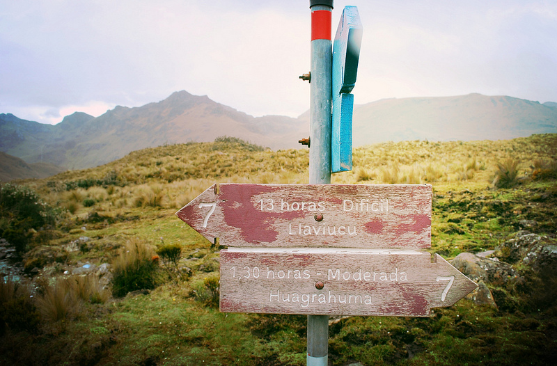
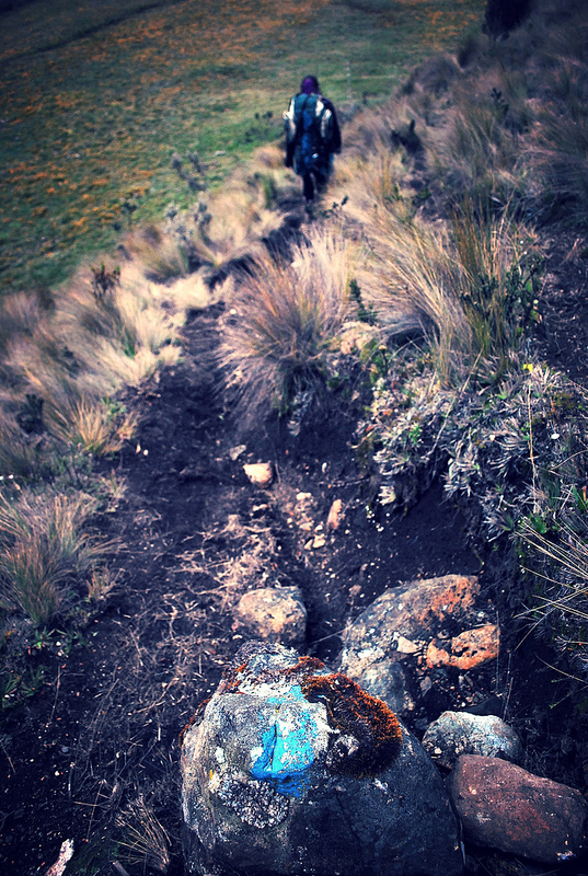
A bus left us off on a highway of clouds. After some searching we found the trailhead we were looking for with no visible trail to justify it. Instead, a blue sign (the color of our chosen route) stuck out of an overgrown field in the shape of an arrow pointing vaguely toward a forest and over a cliff.We hiked blindly for two hours before finding the first blue blaze marking the trail, and then trekked for another two hours to find the second. There were various dark grooves in the grassland that snaked along the hillsides – widening, sometimes intersecting then suddenly disappearing. I guided us with my map, compass and intuition, but Rocio remained intent to remind me every few minutes that we were walking along llama footpaths. Which was true.
After trekking only 10 kilometres the first day, we set up camp in the thick of the polylepis, or ‘paper-tree’ forest, which are one of the highest-growing trees on the planet. Its fascinating branches resembled aged pages pulled from books with wild mushrooms springing up among the roots below. In the morning we hiked a five-kilometre incline to Laguna Luspa, the largest lake in Cajas, spotting a sign for the Inca Trail along the way. I was enticed by the caves and polylepis the arrow pointed toward, and followed the trail alone for a few hours after catching some sun by Luspa’s lakeside. On our last day, the dangerously strong sun followed us halfway out of the park, only to be replaced by those notorious clouds on the way out.
Deep in the ‘badlands’
Once the clouds descended, we automatically veered off-trail, walking through strange terrain we hadn’t encountered on the other days. Cajas National Park retains water like a sponge, so what at first appears to be a nice walk across a pleasant field actually feels like marching on juicy marshmallows. It took a week for my calves to forget the experience.
Once we were walking along Laguna Larga (‘long lake’), droplets began raining down on us. We soon realized it wasn’t a storm, but the frozen crystals of clouds so low (or us, so high) that we were literally hiking through them. The blazes tapered out altogether and were replaced by giant stem rosettes and long, grassy bouquets endemic to the high-alpine páramo. This Andean-specific bioregion translates to ‘badlands’ in English, itself a figurative synonym to ‘wilderness’ or ‘solitude.’With the road behind us and the path long gone, I was right where I wanted to be.“Donde estamos?” yelled Rocio from somewhere in the fog downhill: Where are we?
“I don’t know!” I screamed back in Spanish.
But it was OK.
Getting there:
Ecuador has two international airports, one in the capital of Quito, and another in the coastal city of Guayaquil. From there, you can either fly into the Cuenca airport (Mariscal Lamar International Airport) take a public bus (11 hours from each city, $9-10) or private transport, which varies in cost.
The Guayaquil-Cuenca road cuts right through Cajas, but I suggest you get some rest in Cuenca before heading to the park in the morning. In Cuenca you can find a tour agency to guide and transport you to and from Cajas. If you’re going alone (which the park’s administration strongly advises against) take a taxi ($1-$2.50) to the Cuenca Bus Terminal where you’ll board a Guayaquil-bound bus ($2.00.)
Most backpackers are dropped off at the visitor’s center and refugio, (sleeps six) but more intrepid travelers who acquire maps in advance can be dropped off where they like and camp anywhere within the expansive park.
Bani Amor is a queer travel writer from Brooklyn by way of Ecuador. She left high school at 15 to travel the States, South America, Canada and Asia alone, and currently self-publishes the travel zine Everywhere All The Time from her (temporary) home in Quito, Ecuador.
Do you prefer the trails less travelled?
Join like-minded trekkers by signing up for the S&TT e-mail list. Every week, you’ll get:
- Profiles of little-known hiking destinations
- Gear reviews for backpackers and hikers
- Feature articles on strange and off-beat hiking
Plus we’re 100% spam-free (and proud of it)


