I don’t really care about how many steps I’ve taken or whether I can easily organize photos of my trek in a nifty digital journal. Not interested in gear checklists either.
What I do want is information. I want statistics and maps and field guides so I can identify that weird-ass bug crawling on the roof of my tent. But before modern devices came along, you’d have to haul 30 pounds of books in order to have all that data at hand.
So forget all the fluff and focus on the facts when selecting which hiking apps to download before your trek. Here’s a few programs you might want to consider:
Maps
AlpineQuest GPS (Android)
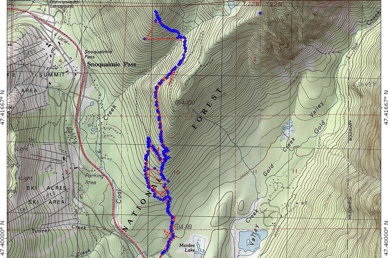
Designed for trekkers that wander far from civilization, AlpineQuest bills itself as a digital alternative to taking piles of hard copy hiking maps. It stays fully operational outside of cell service, so you can pack this app with topographic maps and access them at any time. It also features plenty of statistics and graphics. You can try a lite version for free while the full version fetches $6.49.
Offline Topo Maps (iPhone)
Like AlpineQuest, you can download USGS maps before your trek and take them with you into remote areas where there isn’t any cell reception. This app is very simple and easy to use with a clear interface for topographic or satellite maps. Offline Topo Maps sells for $9.99. There’s also a full-featured version called Gaia GPS.
Field guides
MyNature Animal Tracks
(iPhone and Android)
Figure out what made those imprints – or left that pile of crap – in no time. This unique app provides seven searchable track categories with illustrations of both fore and hind feet plus descriptions of track measurements. Also, MyNature Animal Tracks provides five categories for scat, complete with detailed images. It sells for $2.99.
Leafsnap: An electronic field guide (iphone)
Take a photo of a leaf and this impressive app will identify the tree species using visual recognition software. Created by researchers from Columbia University, the University of Maryland, and the Smithsonian Institution, it contains gorgeous photos of leaves, flowers, fruit, petiole, seeds, and bark. This free app is worth checking out.
GoSkyWatch Planetarium (iPhone)
A fun app to have around the campfire: just point your iPhone at the star-speckled sky and GoSkyWatch identifies constellations and provides information about the celestial body you’re gazing at. All the star data is contained in the app so you don’t need a data connection. This simple-to-use app sells for $3.99.
iBird Pro 2 (Android and iPhone)
This developers of this app bill it as the “world’s best selling field guide app.” I don’t doubt them. Enter the region you’re in, list characteristics of the bird you want to identify and iBird will come up with answers. It mimics bird calls and provides an enormous amount of information about the creatures. You can get iBird Pro2 for $4.99.
Wild Mushrooms of North America and Europe (iPhone)
Fungi can be very difficult to identify. And considering how poisonous some species can be, the more information you have the better. This app provides clear images and plenty of details about the mushrooms you stumble upon while hiking. The lite version is free.
Resource guides
Army Survival
(android and iPhone)
From dealing with poisonous snakes to finding water or building a shelter, the U.S. Army Survival Guide provides vital information for just about any outdoor situation. It includes detailed guides on how to tie knots, predict weather and deal with minor wounds. It sells for $4.99.
GoToAid (iphone)
This app provides illustrated instructions for dealing with medical emergencies ranging from sprains to broken arms. It includes about 400 topics – half of them are, oddly enough, dedicated to the medical issues of cats and dogs. Nevertheless, this is a useful app for the trail. The premium version sells for $4.99.
Sunrise (iPhone)
A simple yet handy app that pinpoints the exact time of sunset, sunrise and twilight based on your location. Great information to have when planning your trek. Sunrise has a $0.99 price tag.
Did I miss a must-have hiking app? Leave a comment below.
Part two in the three-part series ‘Digital Gear,’ which focuses on the use of smartphones in the backcountry. Next week: ‘How to turn your phone into a survivor.’
Do you prefer the trails less travelled?
Join like-minded trekkers by signing up for the S&TT e-mail list. Every week, you’ll get:
- Profiles of little-known hiking destinations
- Gear reviews for backpackers and hikers
- Feature articles on strange and off-beat hiking
Plus we’re 100% spam-free (and proud of it)

