DISTANCE (round-trip)
18 mi (21km)
DIFFICULTY
TIME
2-3 days
ALTERNATIVE TO
Trails in Big Bend National Park
SOLITUDE
Amazingly diverse hiking in a park that's nearly forgotten
Hidden in Western Texas, Guadalupe Mountains National Park is one of the least-visited parks in the system. Bordered by Carlsbad Caverns to the North, this park is part of a large desert ecosystem.
Animals that call this place home include Elk, Cougar, Black Bear, and over 16 species of bats. Guadalupe Peak, the highest mountain in texas at 8,751 feet can be found here.
The Mountains create a varied ecosystem and are somewhat of a refuge from the hot Chihuahuan desert. This vast and beautiful terrain makes for some of the best hiking in the Southwest.
The park is nearly forgotten about, charging only $5 for the entrance fee. This lack of visitors makes for some very remote hiking.
The best hike for solitude is the Pine Springs to McKittrick Canyon Trek, taking the hiker through some of the steepest terrain in the park. It is recommended to start at Pine Springs because the descent to McKittrick Trailhead is much better than ascending it.
Over 4,000 feet in elevation is gained on this hike and all your water must be carried. It is recommended to carry at least two gallons, making the pack extremely heavy.
The trail winds through pine forests, much different than the desert surrounding the mountains. This is a very unique mountain range and many of the plant species are extremely rare.
There is also no transportation available between trailheads and it is important to have enough vehicles to make entry and exit possible
When to go
Spring, Winter, and Fall are the best times to go. It can get icy in the Winter but Summer can truly be miserable in the heat.
Getting there
Located an hour and fifty minutes East of El Paso, take 180E for 113 miles until you spot the National Park entrance. Left at Pine Canyon Drive and park at the Pine Springs Trailhead.
McKittrick Trailhead is 12.5 miles up 180E, turn left at Mckittrick Road, parking at the trail head.
Know before you go
- Be prepared to carry all of your water, be sure to plan how many days the hike will take.
- Watch out for rattlesnakes, especially on hot days.
- Thunderstorms can be fatal in the high altitudes, watch the weather and don’t hike through bad storms.
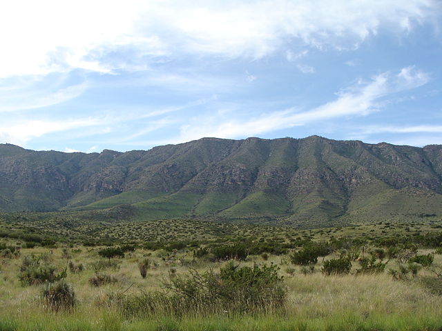
This corner of the desert is part of a vast conservation network which includes Carlsbad Caverns. Photo credit_CC
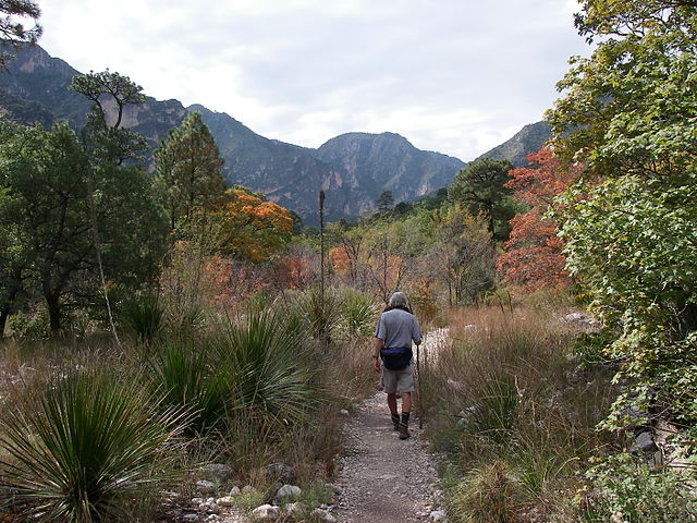
The trail starts off relatively benign and the fall colors can be seen in this shot. Photo credit_CC
Gear Recommendations for this trail:
- Platypus makes a lightweight 2 liter bladder I always carry on desert hikes
- If you'd like the complete hydration system, Platypus makes that too!